Narmada River Map - File Information
| Map Name | Narmada River Map |
|---|---|
| Available Formats | WEBPPDFJPGPNG |
| WEBP Size | 0.20 MB |
| PDF Size | 0.53 MB |
| JPG Size | 0.64 MB |
| PNG Size | 1.76 MB |
| No. of Pages in PDF | 1 |
| Image Height | 2104 Pixels |
| Image Width | 1488 Pixels |
| Category | Geography |
| Related | Indian Rivers Map |
Narmada River Map - Preview
 Preview in Large Size
Narmada River Map - Summary
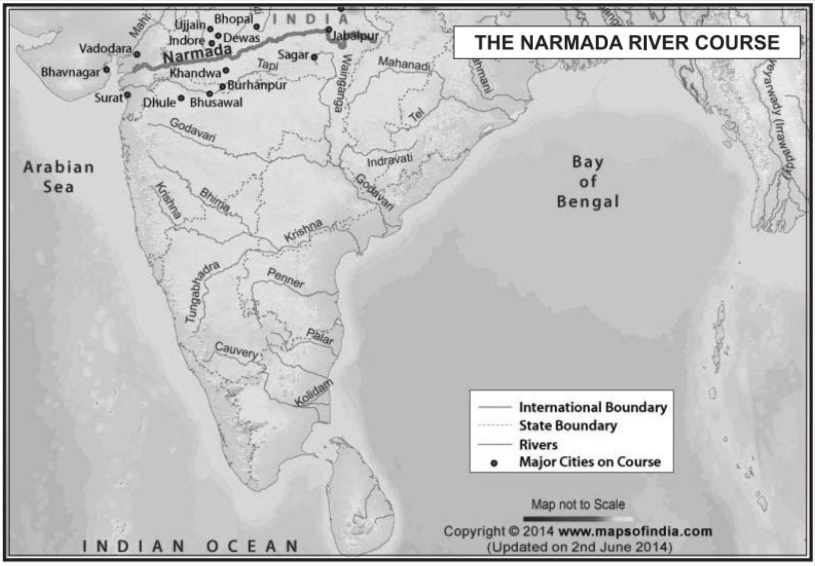
Narmada River is the largest west-flowing river of the peninsula of India. It rises from Narmada Kund, located at Amarkantak, in the Anuppur district of Madhya Pradesh, at an elevation of about 1057 m in the Maikala range. It forms the traditional boundary between North and South India.
The river flows through Madhya Pradesh, Maharashtra, and Gujarat between the Vindhya and Satpura hill ranges before falling into the Gulf of Cambay in the Arabian Sea about 10 km north of Bharuch, Gujarat. The total length of the river from the head to its outfall into the Arabian Sea is 1,333 km.
There are a total of 41 tributaries of the Narmada River. Out of these, 8 important tributaries join the river from the right bank, and 11 important tributaries join from the left bank.
Narmada River on Indian Map
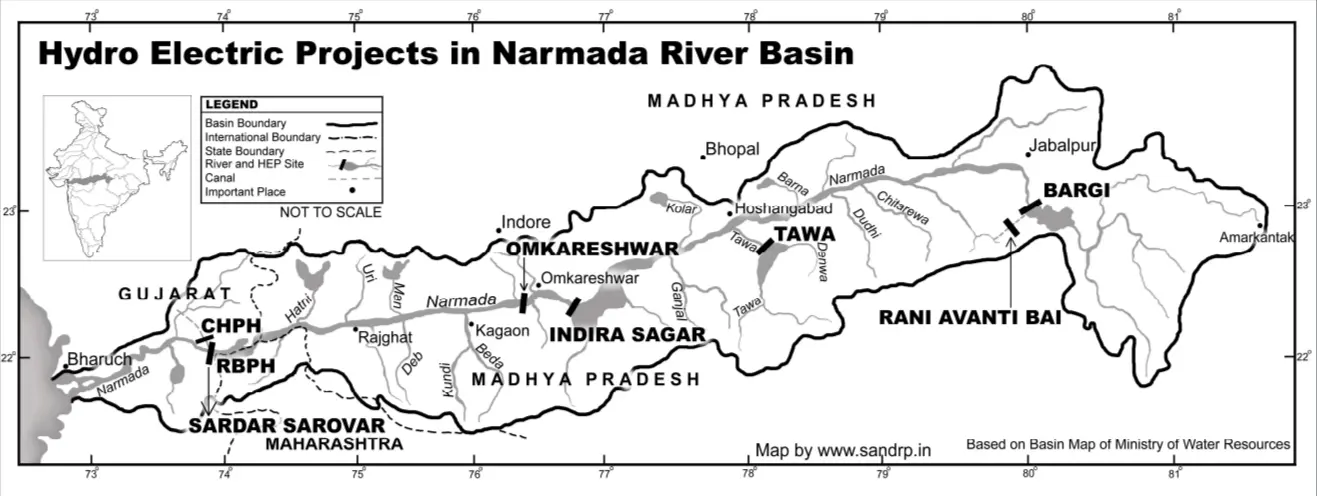
Narmada River Hydro Electric Map in Madhya Pradesh
Narmada River Map - Download Links
- WEBP 0.20MB
- PDF 0.53MB
- JPG 0.64MB
- PNG 1.76MB