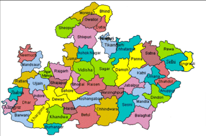
Madhya Pradesh Map with Districts - File Information
| Map Name | Madhya Pradesh Map with Districts |
|---|---|
| Available Formats | WEBPPDFJPGPNG |
| WEBP Size | 0.18 MB |
| PDF Size | 1.02 MB |
| JPG Size | 0.60 MB |
| PNG Size | 1.29 MB |
| No. of Pages in PDF | 1 |
| Image Height | 1980 Pixels |
| Image Width | 1530 Pixels |
| Category | India |
| Related | Madhya Pradesh |
Madhya Pradesh Map with Districts - Preview
 Preview in Large Size
Madhya Pradesh Map with Districts - Summary
Madhya Pradesh is the second-largest state in India, with an area of 3,08,245 sq.km. It is located in Central India. The state is bound on the north by Uttar Pradesh, the east by Chhattisgarh, the south by Maharashtra, and the west by Gujarat and Rajasthan.
The state’s geography is a significant factor in shaping its history and culture. Madhya Pradesh is home to several important landmarks such as the Satpura and Vindhya mountain ranges, the Narmada river, and the Pachmarhi biosphere reserve. These landmarks have played a significant role in shaping the state’s geography, history, and culture.
Madhya Pradesh Map with Geographical
| Total Population in crore as per Census 2011 |
7.27 |
| Rural Population (cr.) & | 5.25 |
| % of rural population to total population | 72.21% |
| Urban Population (cr.) | 2.02 |
| % of urban population to total population | 27.79 |
| Male (cr.) | 3.76 |
| Female (cr.) | 3.51 |
| Scheduled Castes (cr.) | 1.13 |
| % of SC population to total population | 15.54% |
| Scheduled Tribes (cr.) | 1.53 |
| % of ST population to total population | 21.04% |
| Sex Ratio | 931 |
| Density/km2 | 236 |
| Area(Km2) | 3,08,245 |
| Literacy | 69.30% |
Map of Madhya Pradesh
Madhya Pradesh Map with Districts - Download Links
- WEBP 0.18MB
- PDF 1.02MB
- JPG 0.60MB
- PNG 1.29MB