Dausa Map - File Information
| Map Name | Dausa Map |
|---|---|
| Available Formats | WEBPPDFJPGPNG |
| WEBP Size | 0.63 MB |
| PDF Size | 0.43 MB |
| JPG Size | 1.99 MB |
| PNG Size | 3.65 MB |
| No. of Pages in PDF | 1 |
| Image Height | 3240 Pixels |
| Image Width | 3888 Pixels |
| Category | India |
| Related | Rajasthan District Maps |
Dausa Map - Preview
 Preview in Large Size
Dausa Map - Summary
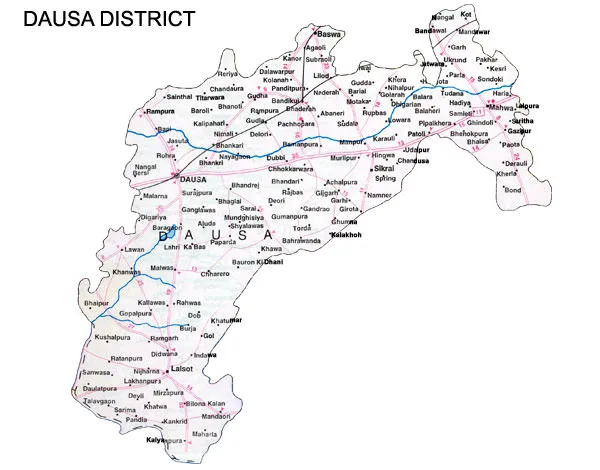
Dausa district is situated in the north-eastern part of the state. It is located between 25.33′ to 27.33′ north latitude and between 76.50′ to 76.90′ eastern longitude. The district is situated on NH-21 from Jaipur to Agra, which is just 55 km from Jaipur. It has an average elevation of 333 meters (1072 feet). It is one of the 5 Districts of the Jaipur division and is surrounded by Jaipur, Alwar, Sawai Madhopur, Karauli, Bharatpur, and Tonk. The area of the district is 3432 Sq. km. and ranks at 32nd among other districts of the state.
Dausa is a city and the administrative headquarters of Dausa district in the state of Rajasthan, India. It is 55 km from Jaipur, 240 km from Delh,i and located on the Jaipur-Agra National Highway.
Dausa is a small ancient town named after a sanskrit word “Dhau-Sa” meaning “Beautiful Like Heaven”. Also referred as “Deva Nagari”, located around 55 km from Jaipur, on National Highway 21. The city was the first headquarters of the former Kachhawaha Dynasty and has much history and archaeological importance linked to it. Situated away from the bustling cities, the town of Dausa offers an authentic rural experience in Rajasthan
Dausa District Road Map
Dausa Map - Download Links
- WEBP 0.63MB
- PDF 0.43MB
- JPG 1.99MB
- PNG 3.65MB