Mira Bhayandar Metro Map 2025 - File Information
| Map Name | Mira Bhayandar Metro Map 2025 |
|---|---|
| Available Formats | WEBPPDFJPGPNG |
| WEBP Size | 0.44 MB |
| PDF Size | 0.31 MB |
| JPG Size | 1.22 MB |
| PNG Size | 5.27 MB |
| No. of Pages in PDF | 1 |
| Image Height | 2526 Pixels |
| Image Width | 1785 Pixels |
| Category | India |
| Related | Maharashtra, Metro Maps |
Mira Bhayandar Metro Map 2025 - Preview
 Preview in Large Size
Mira Bhayandar Metro Map 2025 - Summary
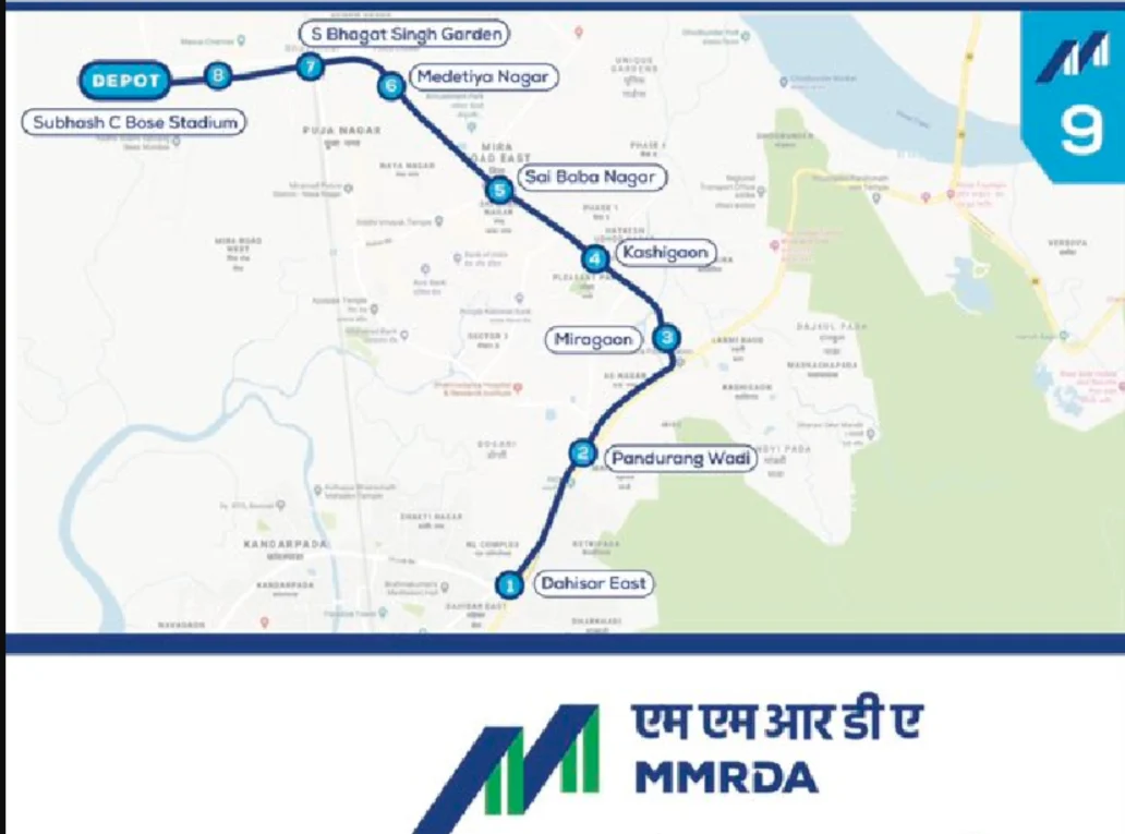
Metro Line 9 is extension of Line 7 from Andheri to CSIA and Dahisar to Mira Bhayander and is 13.581 km long (11.386 km elevated and 2.195km underground) with 10 stations.
It shall provide interconnectivity among the existing Western Express Highway, Western Railway, ongoing Metro Line 2A (Dahisar to D N Nagar) and Metro Line 7(Andheri (E) to Dahisar (E). It shall provide rail based access to the commercial, Govt. bodies and geographical landmarks in Mumbai. It shall reduce the current travel time by anything between 50% and 75% depending on road conditions.
Mira Bhayandar Metro Map 2025 - Download Links
- WEBP 0.44MB
- PDF 0.31MB
- JPG 1.22MB
- PNG 5.27MB