Beas River Map - File Information
| Map Name | Beas River Map |
|---|---|
| Available Formats | WEBPPDFJPGPNG |
| WEBP Size | 0.16 MB |
| PDF Size | 0.53 MB |
| JPG Size | 0.56 MB |
| PNG Size | 1.97 MB |
| No. of Pages in PDF | 1 |
| Image Height | 1494 Pixels |
| Image Width | 2116 Pixels |
| Category | Geography |
| Related | Indian Rivers Map |
Beas River Map - Preview
 Preview in Large Size
Beas River Map - Summary
The River Beas is one of the Indus River Systems of the Himalayas. The River originates from Beas Kund, near Rohtang Pass, at a height of 4,062 m above sea level, on the southern end of the Pir Panjal Range of Distt. Kullu in Himachal Pradesh and flows a distance of about 245 Kms in Himachal and merge with the Sutlej at Harike Pattan south of Amritsar in Punjab after travelling 470 kms.
Beas River Map Key Facts
| Attribute | Details |
|---|---|
| Length | 286 km |
| Source | Beas Kund (Rohtang Pass) |
| Districts Covered | Kullu, Mandi, Kangra |
| Catchment Area | 13,663 sq. km (24.5% of Himachal Pradesh’s area) |
| Hydro Electric Projects (Commissioned + Planned) | 359 projects – 5463 MW |
| Potential Capacity | 5995 MW |
| Main Tributaries | Parbati, Tirthan, Sainj, Harla, Gaj Khad, Chakki, Luni, Mamuni, Uhl, Suketi |
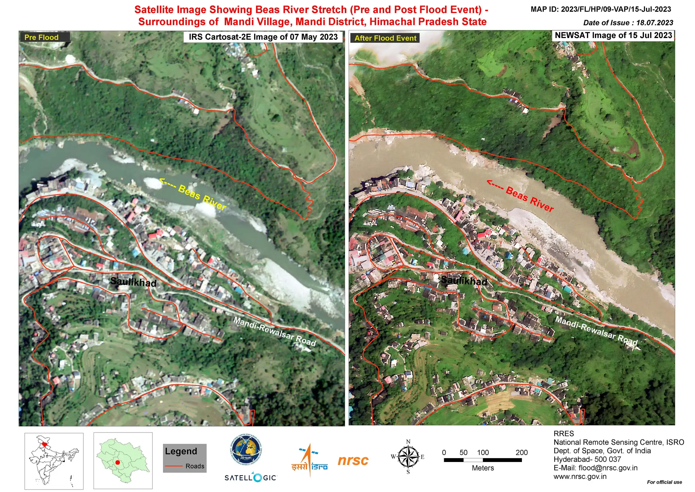
Beas Satellite Map
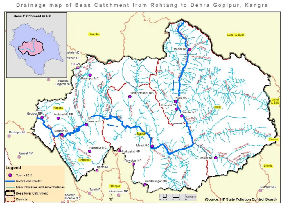
Drainage Map of Beas River
Beas River Map - Download Links
- WEBP 0.16MB
- PDF 0.53MB
- JPG 0.56MB
- PNG 1.97MB