India Geographical Map
Download India Geographical Map PDF or high quality & high resolution image in JPG, PNG or WEBP format using the direct download link given below.
India Geographical Map - File Information
| Map Name | India Geographical Map |
|---|---|
| Source | surveyofindia.gov.in |
| Category | India |
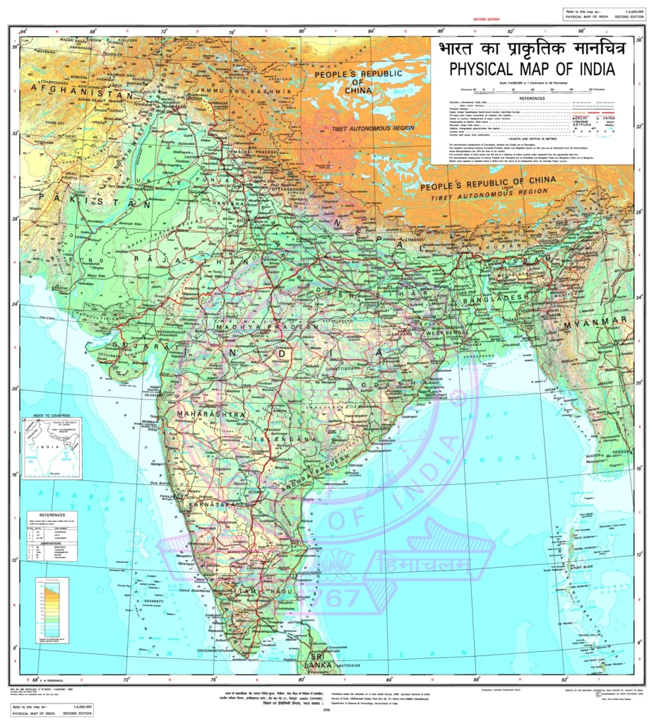
India Geographical Map - Summary
India ranks as the seventh largest country in the world by area, situated on the Indian Plate, a part of the larger Indo-Australian Plate. Its geographical shape is distinctive on the world map, flanked by three major bodies of water.
Spanning approximately 3.28 million square kilometers, India’s mainland stretches from latitude 8°4′ to 37°6′ N and from longitude 68°7′ to 97°25′ E. The Tropic of Cancer, located at 23°30′ N, effectively divides the nation into nearly equal halves. With a coastline that measures 7,517 kilometers in length, the Indian peninsula narrows as it heads south, creating the stunning separation of the Indian Ocean into the Bay of Bengal and the Arabian Sea.
Within its borders, India boasts a rich variety of landforms, ranging from towering mountains and deep valleys to vast plains and plateaus, along with coastal ghats, arid deserts, and numerous islands.