Jamui District Map - File Information
| Map Name | Jamui District Map |
|---|---|
| Available Formats | WEBPPDFJPGPNG |
| WEBP Size | 0.39 MB |
| PDF Size | 0.99 MB |
| JPG Size | 1.39 MB |
| PNG Size | 2.31 MB |
| No. of Pages in PDF | 1 |
| Image Height | 2525 Pixels |
| Image Width | 3576 Pixels |
| Category | India |
| Related | Bihar, Bihar District Maps |
Jamui District Map - Preview
 Preview in Large Size
Jamui District Map - Summary
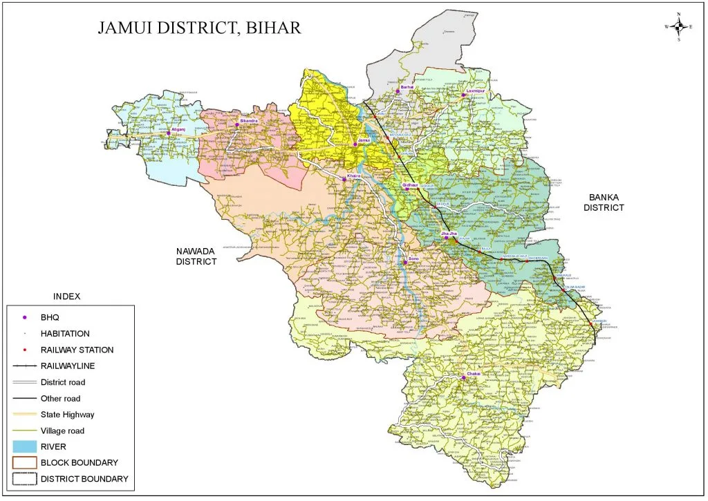
Jamui is a town and a municipality in Jamui district in the Indian state of Bihar. It is the district headquarters of Jamui district. Jamui was formed as a district on 21 February 1991 as a result of its separation from Munger. It is part of the Munger Division. Jamui District is famous for the big fair that takes place here which is also called as kali mela. Minto Tower, Jamui: The tower holds historical importance in modern Indian history and is the center of Gidhaur city.
The old name of Jamui has been traced as Jambhubani in a copper plate which is kept in Patna Museum.
Jamui Physiographical Division
Most of the part of the district has hilly topography. The western portion of Jamui like Sikandra Jamui & a little part of Khaira has a plain area. Sikandra block is situated in the alluvial zone. A sizeable part of the district comprises plains which are paddy-growing lands. The southern part of the district is covered with hills and forest characteristically reminiscent of the Chhotanagpur plateau in physical features. The hills of the district are considered to be the out–laying extension of the Indhya Range. The southwest part of the district has another block of hills known as Gidheswar Pahar.
Jamui District in Hindi
Jamui District Map - Download Links
- WEBP 0.39MB
- PDF 0.99MB
- JPG 1.39MB
- PNG 2.31MB