Madhya Pradesh River Map - File Information
| Map Name | Madhya Pradesh River Map |
|---|---|
| Available Formats | WEBPPDFJPGPNG |
| WEBP Size | 0.63 MB |
| PDF Size | 0.33 MB |
| JPG Size | 2.07 MB |
| PNG Size | 7.23 MB |
| No. of Pages in PDF | 1 |
| Image Height | 2677 Pixels |
| Image Width | 3789 Pixels |
| Category | Geography |
| Related | Madhya Pradesh |
Madhya Pradesh River Map - Preview
 Preview in Large Size
Madhya Pradesh River Map - Summary
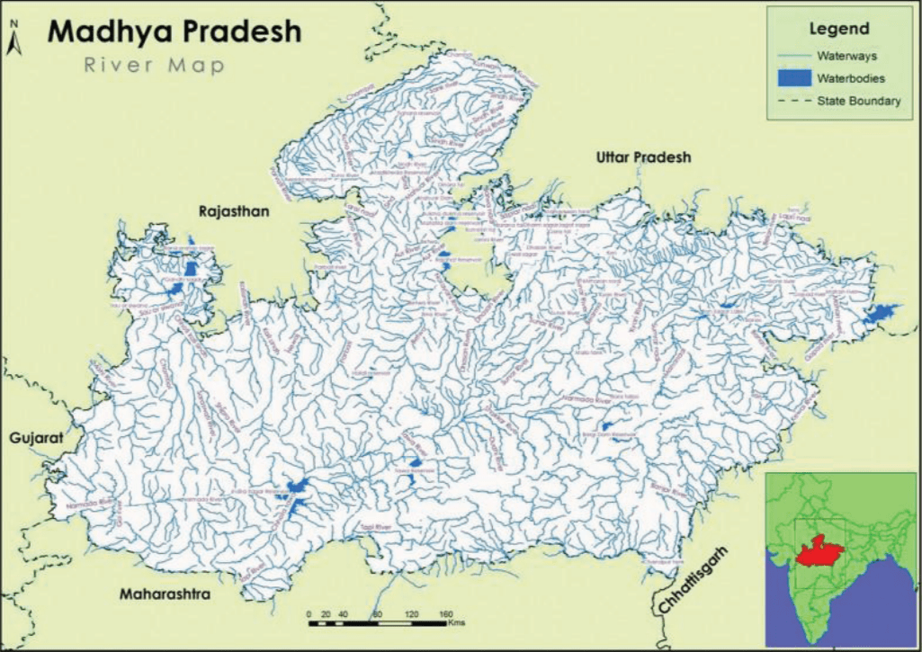
The Narmada, Tapi, and Mahi rivers flow from east to west. The Vindhyas form the southern boundary of the Ganga Basin, with the western part of the basin draining into the Yamuna and the eastern part directly into the Ganga itself. All the rivers that drain into the Ganga basin flow from south to north, with the Chambal, Shipra, Kali Sindh, Parbati, Kuno, Sind, Betwa, Dhasan, and Ken rivers being the main tributaries of the Yamuna, joining the Ganga.
The Madhya Pradesh Rivers Network Map shows the Rivers Flowing in and out of Madhya Pradesh. Ganga, Godavari, Tapti, Narmada, and Mahi are the major river basins fed by the state. The State is further divided into ten river sub basins.
MP River Map
Madhya Pradesh River Map - Download Links
- WEBP 0.63MB
- PDF 0.33MB
- JPG 2.07MB
- PNG 7.23MB