Mumbai Metro Route Map - File Information
| Map Name | Mumbai Metro Route Map |
|---|---|
| Available Formats | WEBPPDFJPGPNG |
| WEBP Size | 0.32 MB |
| PDF Size | 0.13 MB |
| JPG Size | 0.99 MB |
| PNG Size | 2.64 MB |
| No. of Pages in PDF | 1 |
| Image Height | 2864 Pixels |
| Image Width | 2025 Pixels |
| Category | India |
| Related | Metro Maps |
Mumbai Metro Route Map - Preview
 Preview in Large Size
Mumbai Metro Route Map - Summary
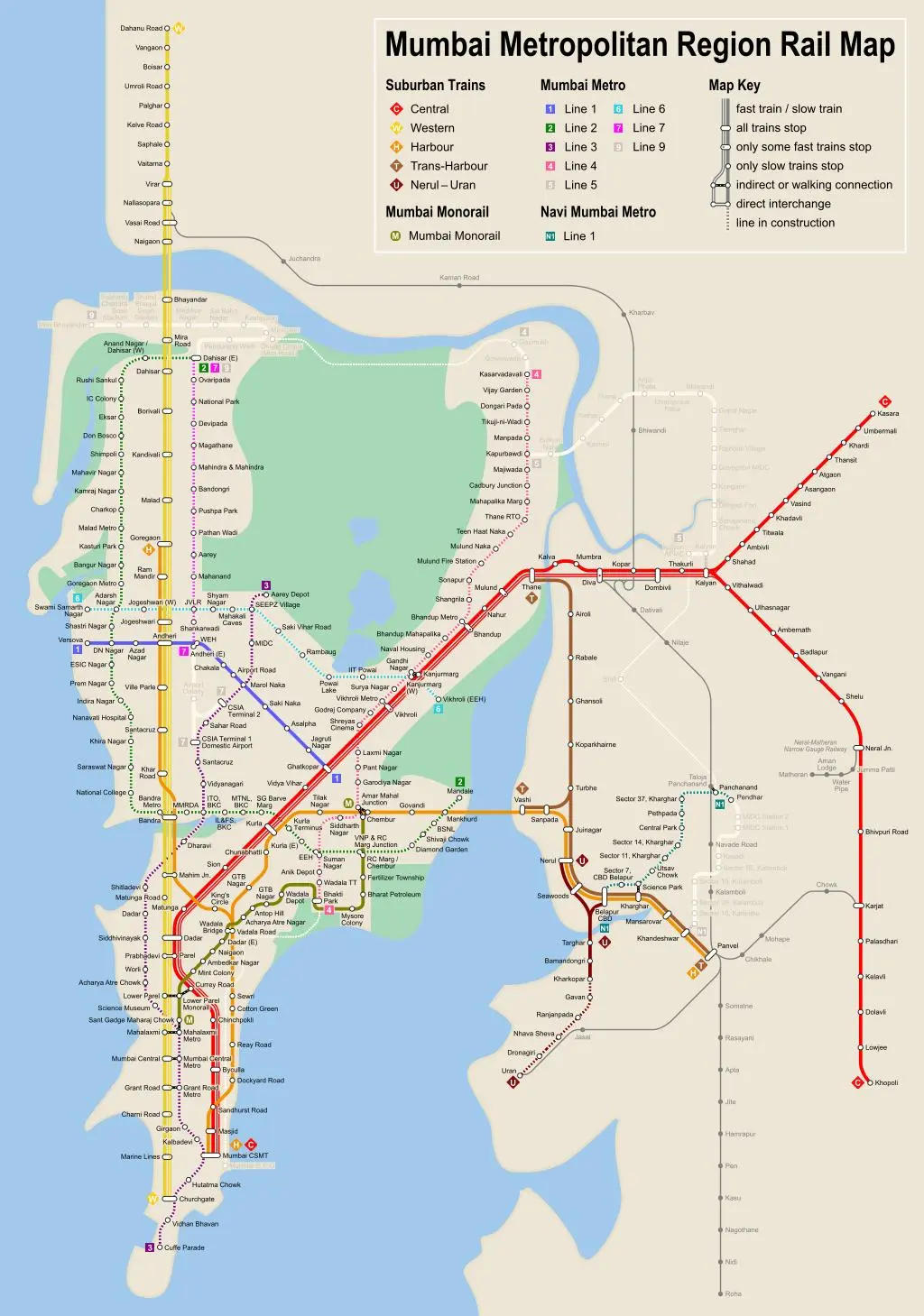
The Mumbai – Bombay metro map shows all the stations and lines of the Mumbai – Bombay metro. This metro map of Mumbai – Bombay will allow you to easily plan your routes in the metro of Mumbai – Bombay in Maharashtra – India. The Mumbai – Bombay metro map is downloadable in PDF, printable and free.
Metro Mumbai – Bombay is a rapid transit system under construction in the Indian city of Mumbai. The system is designed to reduce traffic congestion in the city and will be built in three phases over a 15-year period, with overall completion expected in 2021. When complete, the system will comprise three high-capacity metro railway lines, spanning a total of 63 kilometres (39 mi) as its mentioned in Metro map Mumbai – Bombay. The Mumbai Metro operator is Mumbai Metro One Pvt Ltd (MMOPL), a joint venture company formed by Reliance Infrastructure, Veolia Transport and the Mumbai Metropolitan Region Development Authority (MMRDA).
Mumbai Metro Rail Map
Mumbai Metro Route Map - Download Links
- WEBP 0.32MB
- PDF 0.13MB
- JPG 0.99MB
- PNG 2.64MB