Indus River Map - File Information
| Map Name | Indus River Map |
|---|---|
| Available Formats | WEBPPDFJPGPNG |
| WEBP Size | 0.08 MB |
| PDF Size | 0.20 MB |
| JPG Size | 0.34 MB |
| PNG Size | 0.83 MB |
| No. of Pages in PDF | 1 |
| Image Height | 2202 Pixels |
| Image Width | 1407 Pixels |
| Category | Geography |
| Related | Indian Rivers Map |
Indus River Map - Preview
 Preview in Large Size
Indus River Map - Summary
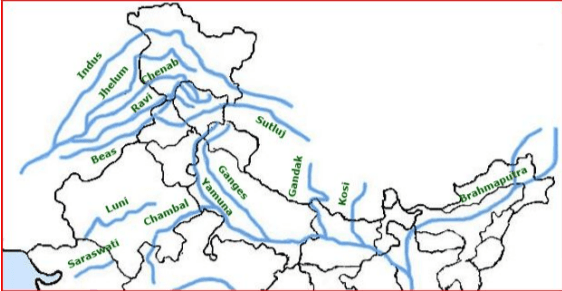
The Indus originates in Tibet and flows through Jammu and Kashmir, Ladakh, and Pakistan before falling into the Arabian Sea. It is one of the longest rivers in Asia and has many tributaries like Jhelum, Chenab, Ravi, Beas, and Sutlej. Rivers in India are considered sacred and many people worship them. They also provide water, irrigation, transport, electricity, and livelihood to millions of Indians.
Indus Basin Map
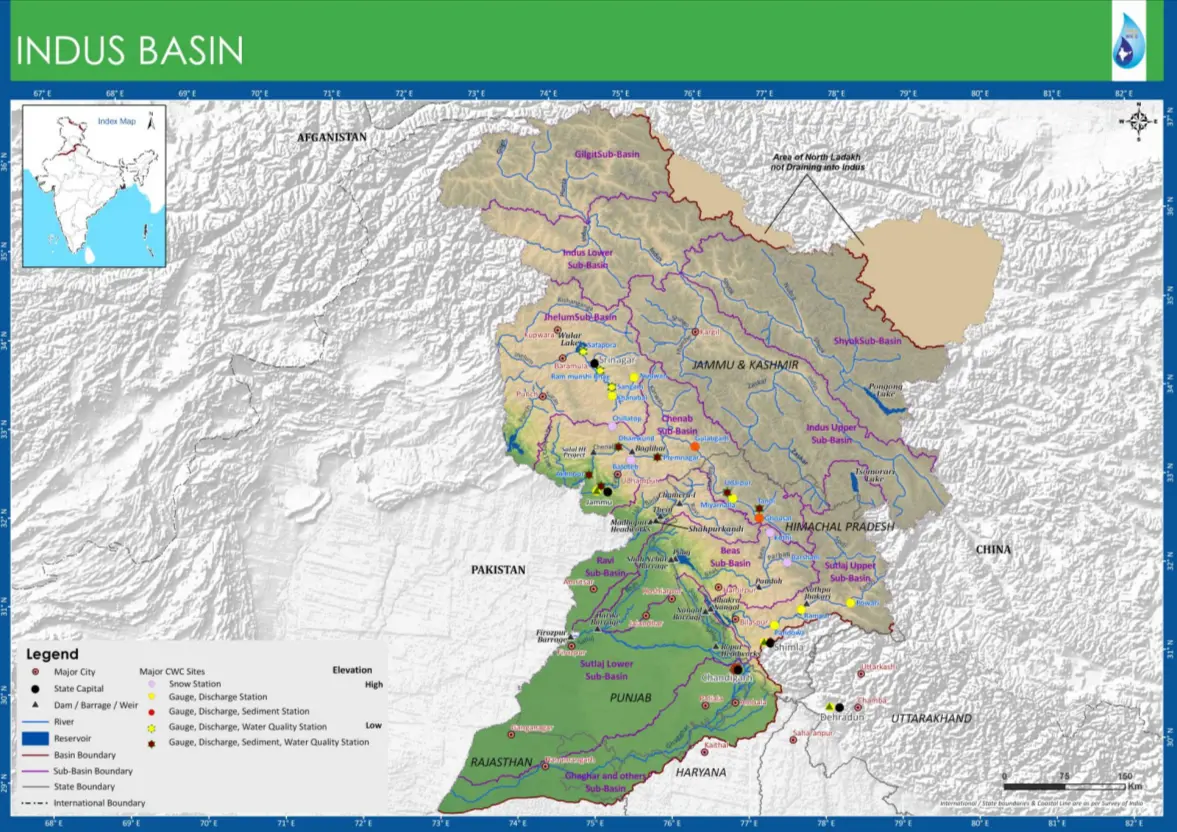
Indus River
- Ancient name → Sindhu
- Origin → Bokharchu Glacier, Near Mansarovar In Tibet, Called Singi Khamban / Lion’s mouth
- Enters In India through Ladakh, flows only in J &K
- Enters Pak through hair pin bend of Nanga Parbat
- Finally Discharges in Arabian Sea
- Flows approx. ( 709 / 2880 ) Km in India
Indus River Map - Download Links
- WEBP 0.08MB
- PDF 0.20MB
- JPG 0.34MB
- PNG 0.83MB