Download Saran District Map PDF or high quality & high resolution image in JPG, PNG or WEBP format using the direct download links given below.
Saran District Map - File Information
Saran District Map - Preview
Saran District Map - Summary
Saran district was included in the Patna Division when the Commissioner’s Divisions were set up in 1829. It was separated from Champaran in 1866 when it (Champaran) was constituted into a separate district. Saran was made a part of the Tirhut Division when the latter was created in 1908. By this time there were three subdivisions in this district: Saran, Siwan, and Gopalganj.
List of Taluka Block in Saran District
Tehsil/C.D Block Name
Total : Rural+Urban Population (2001)
Total : Rural+Urban Population (2011)
Pin Code
Amnour
168,339
200,107
841401
Baniapur
217,270
262,267
841403
Chapra
363,036
441,469
841301
Dariapur
228,372
294,903
841221
Dighwara
107,912
129,585
841207
Ekma
181,518
214,122
841208
Garkha
221,388
268,284
841311
Ishupur
121,265
146,255
841411
Jalalpur
137,689
173,087
841412
Lahladpur
70,078
79,803
841224
Maker
76,251
84,658
841215
Manjhi
225,276
268,523
841313
Marhaura
214,042
262,710
841418
Mashrakh
156,844
188,612
841417
Nagra
96,365
123,854
841442
Panapur
100,535
121,666
N.A
Parsa
125,097
155,380
841219
Revelganj
99,010
119,179
841305
Sonepur
220,271
269,943
841101
Taraiya
118,143
138,694
841424
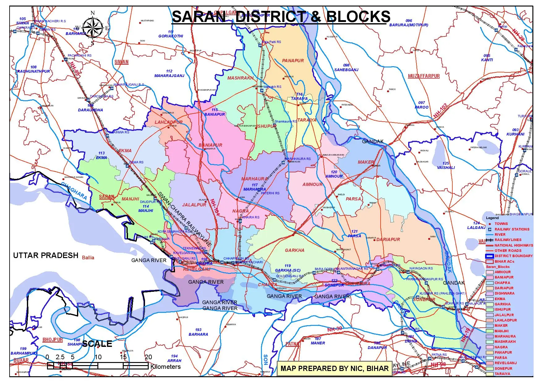
Saran District & Block Map
saran-district-map
Saran District Map - Download Links
0.87MB 2.27MB 2.59MB 5.93MB
 Preview in Large Size